Geo Techenical Survey
Geo Techenical Survey
Geotechnical Survey Foundation
- Design and Geotechnical Investigation
- Material Testing and Pavement Design
- Slope Stability Analysis and Mitigation
- Geological and Hydro-geological Appraisal
- Geophysical and Stratification Analysis
Authoritative Geotechnical Investigation Survey Services in Chennai – Gridline Surveys & Geospatial
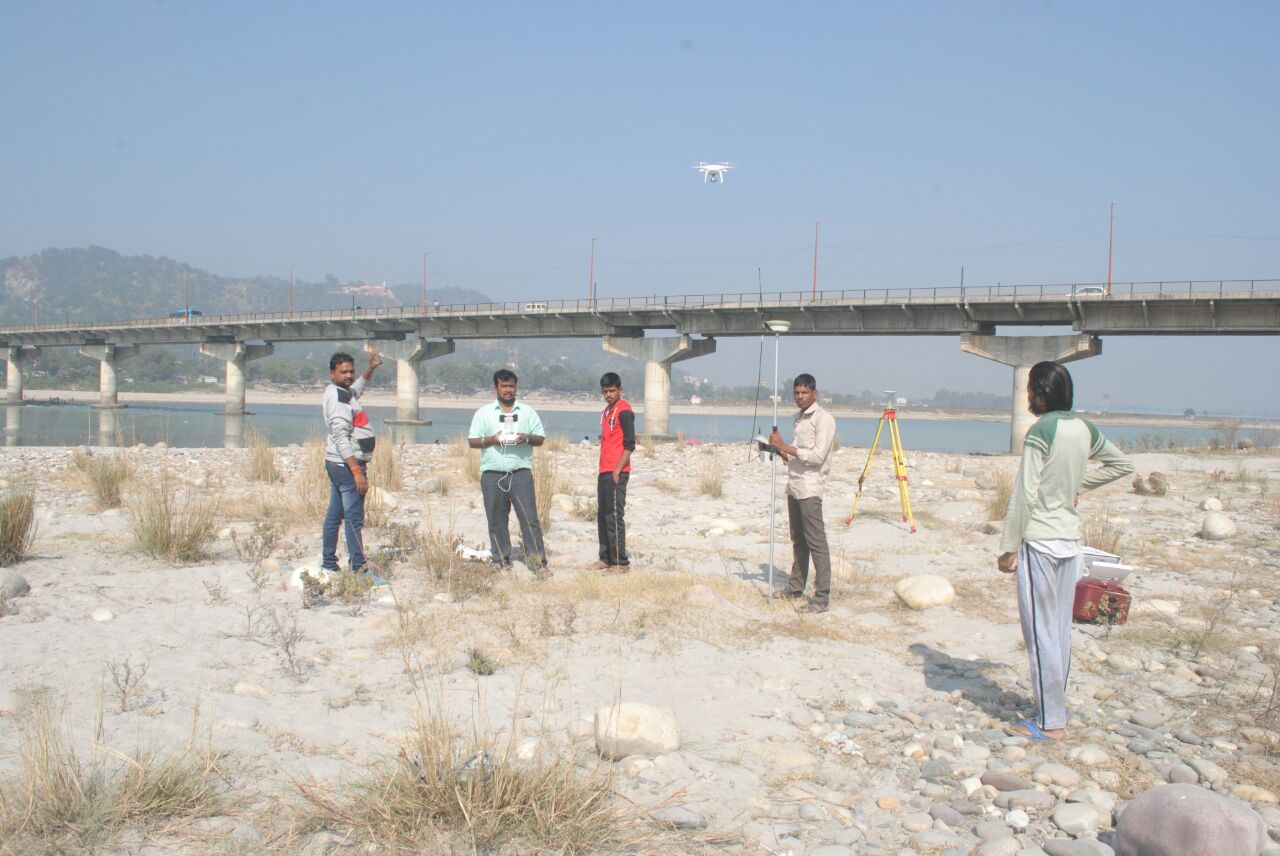
Before any iconic multi-story building, expansive highway corridor, or massive industrial plant can take shape, the ground beneath it must be thoroughly understood. Soil layers shift, groundwater tables fluctuate, and varying geological strata dictate how a structure reacts to load pressures. Executing structural construction without scientific ground testing can lead to catastrophic foundation failures, cracking walls, and extreme cost overruns. Gridline Surveys and Geospatial Pvt. Ltd. provides the deep subsurface intelligence required to anchor your projects safely.
As a premier Geotechnical Investigation Surveyor in Chennai backed by a Government of India Certificate and 21 years of field experience, we deliver comprehensive sub-surface data across India. We translate raw underground layers into actionable engineering blueprints, ensuring your foundations comply perfectly with international civil safety standards.
Our Core Geotechnical Engineering Solutions
A successful development starts with understanding the unique soil dynamics of your location. Our expert engineers provide targeted sub-surface investigation workflows designed for complex structural designs:
-
Advanced Geotechnical Survey Foundation Design
The lifespan of a structure relies entirely on how its foundation transfers load weight to the earth. We execute rigorous boring and field probing to analyze soil density and rock characteristics. Our engineering reports provide structural teams with the critical parameters they need—including safe soil bearing capacity (SBC), expected settlement calculations, and recommended pile depths—to design stable shallow or deep raft foundations.
-
Comprehensive Subsurface Design & Geotechnical Investigation
We manage your end-to-end site exploration using advanced, non-destructive field testing methods. Our engineers drill exploratory boreholes, collect undisturbed core samples, and execute Standard Penetration Tests (SPT) directly on site. This detailed data maps the underground water levels and identifies hidden soil layers, helping you avoid surprises during the excavation phase.
-
Material Testing & Highway Pavement Design
Roads and heavy-duty industrial pavements must endure thousands of tons of continuous vehicle traffic. We conduct thorough laboratory material testing on site soils and sub-base layers. By evaluating the California Bearing Ratio (CBR) and soil plasticity indices, we help transportation engineers design optimal pavement thicknesses, select resilient asphalt compositions, and construct durable, long-lasting roadways.
-
Slope Stability Analysis & Landslide Mitigation
Constructing foundations on steep hill terrains or carving out deep highway cuts creates immense structural risks. Our teams perform complex slope stability analysis to measure internal soil friction, shear strengths, and slip planes. We deliver clear mathematical risk profiles and design effective mitigation strategies—such as retaining walls, soil nailing, and customized drainage systems—to secure unstable slopes.
-
Geological & Hydro-Geological Appraisals
Large-scale infrastructure developments can alter natural groundwater paths. We perform comprehensive hydro-geological appraisals to map out shallow aquifers, identify natural water channels, and measure soil permeability rates. This protective evaluation ensures your deep basement layouts remain completely dry and guarded against water pressure damage during severe monsoon seasons.
-
Geophysical & Stratification Analysis
To map vast land parcels swiftly without digging hundreds of holes, we employ advanced non-invasive geophysical methods. Using Electrical Resistivity Tomography (ERT) and seismic refraction profiling, we create high-resolution cross-sectional maps of underground stratification layers, pinpointing hidden cavities, weak soft-clay pockets, and deep bedrock baselines with absolute precision.
Why Choose Gridline Surveys in Chennai?
Selecting the right partner for a geotechnical investigation survey in Chennai directly impacts the long-term safety and financial stability of your civil investments:
- 21 Years of Real-World Geodetic Experience:
We understand Chennai's unique coastal soils, soft marine clays, and changing water tables intimately, allowing us to deliver highly accurate field recommendations.
- Government Certified Standing:
Our official credentials ensure that all generated soil test records, bearing capacity charts, and laboratory reports carry robust legal weight before municipal corporations and national audit boards.
- Seamless Engineering Data Packages:
We eliminate data gaps. Our field data integrates smoothly with structural engineering platforms, allowing design teams to move directly from underground mapping straight into foundational drafts.
Secure Your Structures from the Ground Up Today
Do not leave your building foundations, structural safety, or pavement lifespans to guesswork. Partner with Chennai's trusted geotechnical and soil investigation experts to build your next master project on rock-solid, verified engineering data.
© 2023. Gridline Surveys and Geospatial (P) Ltd copyrights. All Rights Reserved. Designed by Justsee