Utility Survey
Utility Survey
- Water
- Sewerage
- Gas
- Pipe Line
- Utility Locating & Marking
- Utility Survey Design/Specification
- Subsurface Utility Engineering (SUE)
- Construction Engineering and Inspection (CEI)
Advanced Subsurface Utility Survey Services in Chennai – Gridline Surveys & Geospatial
Excavating blind in a rapidly growing metropolitan area like Chennai is an immense operational risk. Striking an underground water main, a high-voltage electrical conduit, or a gas pipeline can lead to disastrous consequences: multi-million rupee repair penalties, project shutdowns, civil liabilities, and severe threats to human life. Gridline Surveys and Geospatial Pvt. Ltd. provides advanced subsurface engineering to illuminate the invisible network of buried infrastructure beneath your site.
As a premier Utility Surveyor in Chennai, our company holds a Government of India Certificate and brings 21 years of field experience to civil engineering, infrastructure, and urban redevelopment projects across India. We deliver accurate 3D utility maps that let project managers design, excavate, and build with total confidence.
The Risk of Hidden Infrastructure
The space beneath our cities contains an intricate maze of essential networks. Standard surface surveys cannot detect these buried assets. Our specialized utility surveyors in Chennai leverage non-destructive detection technologies to safely locate, classify, and map your subsurface networks.
Our End-to-End Utility Surveying Solutions
We provide a comprehensive suite of utility detection and engineering inspection services to keep your project safely on track:
-
Multi-Network Utility Locating & Marking
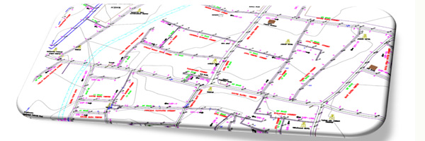
We detect and accurately locate multiple types of hidden infrastructure across municipal and industrial properties:
Water & Sewerage Networks: Tracing deep concrete, metallic, and PVC pipelines to map water distribution and waste disposal pathways.
Gas & Petroleum Pipelines: Locating critical fuel and high-pressure gas conduits with zero-touch, spark-free detection methods.
Telecom & Electrical Conduits: Mapping buried high-voltage cables and optical fiber networks.
Once detected, we mark these networks directly on the ground using international color-coding standards, creating an immediate visual guide for your excavation crews.
-
Subsurface Utility Engineering (SUE)
Our team performs thorough Subsurface Utility Engineering (SUE) in strict accordance with global quality standards. We categorize utility data into four distinct quality levels, giving engineers a transparent look at data reliability:
Quality Level D (QL-D): Gathering and reviewing existing utility records, schematic drawings, and verbal recollections.
Quality Level C (QL-C): Correlating written records with visible surface features like manholes, valve boxes, and utility poles.
Quality Level B (QL-B): Using advanced geophysical methods like Ground Penetrating Radar (GPR) and electromagnetic pipe locators to mark horizontal positions.
Quality Level A (QL-A): Utilizing non-destructive vacuum excavation (potholing) to visually confirm the exact 3D coordinates, size, material, and depth of the utility.
-
Utility Survey Design & Specification
We help project developers draft accurate Utility Survey Designs and Specifications before the construction bidding process begins. By assessing site history and engineering goals, we outline the exact geophysical methods, coverage areas, and accuracy levels required for your specific project. This proactive step helps eliminate surprise change-orders from contractors downstream.
-
Construction Engineering and Inspection (CEI)
During the critical construction phase, our Construction Engineering and Inspection (CEI) teams provide continuous on-site monitoring. We verify that new utility installations match your engineering specifications perfectly, audit backfilling and safety protocols, and build highly accurate, final "as-built" utility maps for your long-term facility management.
Why Choose Gridline Surveys in Chennai?
Selecting the right team for utility surveying in Chennai determines the safety of your field crews and the financial predictability of your project.
- 21+ Years of Geospatial Expertise:
Two decades of hands-on experience means we understand Chennai's unique urban geology, soil conditions, and municipal water layouts intimately.
- Government Certified Standing:
Our official Govt. of India credentials ensure our utility engineering reports carry the regulatory compliance weight required by municipal authorities and highway departments.
- State-of-the-Art Detection Tech:
We eliminate guesswork by deploying advanced dual-frequency Ground Penetrating Radar (GPR), multi-frequency electromagnetic locators, and high-precision Total Stations.
Eliminate Utility Strike Risks on Your Next Site
Do not let an unexpected buried pipe ruin your construction budget and timeline. Partner with Chennai's trusted subsurface utility engineering experts to protect your workers and your bottom line.
© 2023. Gridline Surveys and Geospatial (P) Ltd copyrights. All Rights Reserved. Designed by Justsee