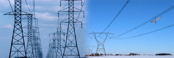
Powerline Survey
Powerline Survey
- Check
- Alignment
- Pit survey
- Land Plan
- PLs Cad
Advanced Power Line Survey Services in Chennai – Gridline Surveys & Geospatial
The rapid expansion of energy infrastructure demands absolute precision in the planning, engineering, and construction of overhead transmission lines. A minor error in corridor mapping or terrain evaluation can lead to catastrophic structural failure, clearance violations, or major project delays. Gridline Surveys and Geospatial Pvt. Ltd. provides industry-leading geospatial engineering to deliver high-voltage transmission pathways with flawless mathematical accuracy.
As a premier Power Line Surveyor in Chennai backed by a Government of India Certificate and 21 years of field experience, we support power utilities, EPC contractors, and energy developers across India. Utilizing the industry-standard PLS-CADD software alongside high-precision field data collection methods, we ensure that your power line networks are safe, cost-efficient, and structurally optimized.
Technical Solutions for Power Line Surveys
A power line corridor survey requires specific engineering processes designed for high-voltage distribution. Our specialized power line surveyors in Chennai manage every phase of the project cycle:
-
Route Alignment Selection & Optimization
Finding the most efficient path for a transmission line involves evaluating terrain gradients, environmental barriers, and built infrastructure. We conduct comprehensive route alignment surveys to identify paths that minimize right-of-way (RoW) conflicts, reduce structural costs, and maintain safe clearance distances from existing buildings or geographical features.
-
Comprehensive Alignment Checks
Over time or during phase upgrades, existing power line paths can drift due to soil movement, vegetation growth, or mechanical stress. We perform highly accurate corridor alignment checks using Total Stations and dual-frequency RTK-GPS. Our team measures cross-arm configurations, wire positions, conductor sags, and horizontal profiles to flag structural deformations or legal encroachment before they turn into operational failures.
-
Precise Pit Surveys & Tower Foundation Spotting
The stability of a transmission tower depends on its concrete foundation, which must be perfectly anchored. Our field teams conduct precise pit surveys at each designated tower location. We establish coordinate references and exact ground elevations to calculate proper excavation boundaries, assess structural slope stability, and ensure the foundation anchors are perfectly positioned.
-
Comprehensive Land Plans & RoW Documentation
Securing statutory clearance and right-of-way (RoW) access requires authoritative land documentation. We generate comprehensive land plans that meticulously detail every property parcel intersected by the proposed transmission line corridor. These maps clearly show the corridor boundaries, utility easements, and impacted physical features, helping developers streamline legal acquisitions and obtain clearances from local state bodies.
-
Advanced PLS-CADD Modeling & Optimization
Field measurements only reach their full engineering potential when translated into specialized design ecosystems. Gridline Surveys heavily utilizes PLS-CADD (Power Line Systems - Computer Aided Design and Drafting), the global gold standard for overhead line engineering.
We import our field-captured 3D terrain coordinates directly into PLS-CADD to generate comprehensive digital models. Within this platform, we support engineering teams with:
Optimum Tower Spotting: Automatically placing tower structures at ideal intervals to minimize material costs while respecting ground clearance rules.
Sag & Tension Analysis: Simulating conductor behavior under varying environmental conditions like high winds and extreme heat.
Clearance Calculations: Checking vertical ground clearance, phase-to-phase spacing, and safety distances from trees or intersecting roadways.
Why Gridline Surveys is Chennai’s Leading Power Line Surveyor
Executing high-voltage infrastructure projects demands technical accountability and reliable credentials. Energy developers choose Gridline Surveys because:
- 21+ Years of Proven Field Expertise:
We have completed complex power line, route alignment, and utility mapping projects across India’s varied terrains.
- Government Certified Standing:
Our official Govt. of India certification guarantees that our survey practices, baseline benchmarks, and structural transfers align with national engineering standards.
- State-of-the-Art Technology:
We eliminate human error by combining precision field instrumentation with advanced software workflows, providing digital deliverables that integrate smoothly into larger BIM, GIS, and asset management databases.
Optimize Your Next Power Infrastructure Project
Do not leave the structural integrity and placement of your high-voltage transmission networks to guesswork. Partner with Chennai’s trusted power line geospatial experts to bring your energy project to life with total confidence.
Consult Our Power Line Engineering Team Contact Gridline Surveys and Geospatial Pvt. Ltd. today to discuss your transmission corridor, pit survey, or PLS-CADD design requirements in Chennai and throughout India.
© 2023. Gridline Surveys and Geospatial (P) Ltd copyrights. All Rights Reserved. Designed by Justsee