Property Survey
Property Survey
- Boundary
- Parcel
- Right-of-Way & Route Surveys
- ALTA/ACSM Surveys
- Topographic Surveys
- Hazardous Waste Site Surveys
- Architectural As-Built Surveys
- Setting Out
- Boundary
- Collums
- Pillar Marking
- Layout
- Route Alignment
- Road and Railway
- Transmission
Authoritative Property Survey Services in Chennai – Gridline Surveys & Geospatial
Whether you are purchasing a commercial plot, resolving a boundary dispute, or launching a multi-crore infrastructure development, your project hinges on flawless land intelligence. Gridline Surveys and Geospatial Pvt. Ltd. stands as a premier geospatial firm serving corporate, government, and private clients across India.
As a premier Property Surveyor in Chennai, our firm brings a Government of India Certificate and over 21 years of field experience directly to your site. We combine traditional legal surveying precision with modern geospatial technology to secure your boundaries, safeguard your investments, and streamline your engineering workflows.
Comprehensive Property Surveying Solutions
Our deep industry experience allows us to provide a comprehensive suite of property surveying services designed to meet rigorous legal, financial, and construction standards.
-
Land Boundary & Parcel Mapping
A clear title begins with undisputed borders. Our property surveyors in Chennai conduct rigorous boundary and parcel surveys to locate, measure, and officially map the exact geographic limits of your real estate asset. We cross-reference historical deeds, state land revenue records, and physical evidence to resolve or prevent costly encroachment disputes.
-
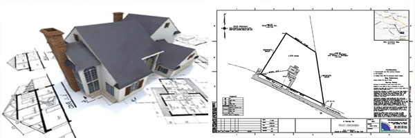
Commercial ALTA/ACSM Land Title Surveys
For high-stakes commercial real estate transactions, standard surveys fall short. We deliver exhaustive ALTA/ACSM surveys that comply fully with international title insurance and lending requirements. These plans meticulously document property improvements, easements, utility access points, rights-of-way, and zoning visual data.
-
Right-of-Way (RoW) & Route Surveys
Acquiring and clearing corridors for linear assets requires absolute precision. We specialize in mapping out right-of-way boundaries and route alignments for utilities, highways, and municipal infrastructure. This ensures smooth legal transitions and minimizes friction with neighboring land holdings.
-
High-Precision Construction Setting Out
Translate your architectural blueprints to the physical earth with zero margin for error. Our engineering setting-out services give contractors exact points on the ground to begin structural work:
Boundary Verification: Confirming the fence line before physical work starts.
Column & Pillar Marking: Pinpointing exact structural load centers for multi-story buildings.
Layout Demarcation: Outlining roads, drainage networks, and foundational footprints.
-
Architectural As-Built & Topographic Surveys
Topographic Surveys: Before drafting begins, we map the elevation, contours, utilities, and natural features of your parcel.
Architectural As-Built Surveys: After construction completes, we deliver accurate mathematical maps documenting the exact physical location of the finished structures. This is a critical step for municipal completion certificates and property handovers.
-
Hazardous Waste Site Surveys
Developing on industrial or brownfield land presents unique safety and environmental challenges. Our specialized teams perform hazardous waste site property surveys under strict safety protocols. We map out contaminated zones, monitoring wells, and topography to aid remediation and regulatory compliance.
-
Heavy Transit & Utility Route Alignment
We carry specialized expertise in executing macro-level property mapping for major distribution corridors:
Road and Railway Corridors: Mapping horizontal and vertical properties for seamless transportation links.
Transmission Lines: Plotting optimized tower locations, catenary clearances, and easement boundaries across varying terrains.
Why Gridline Surveys is Chennai's Trusted Partner
Choosing the right property surveyors in Chennai determines the safety of your investment. Gridline Surveys offers unparalleled reliability because:
- 21 Years of Field Proven Expertise:
We understand the complex urban layout of Chennai, coastal geological factors, and local land administration systems intimately.
- Government Certified Standing:
Our certifications ensure that all generated survey drawings, layout maps, and boundary validations hold robust legal weight before courts, municipal bodies, and banks.
- Advanced Technology Stack:
We eliminate human error by deploying dual-frequency RTK GPS, high-accuracy Total Stations, and industry-standard CAD/GIS mapping software.
Secure Your Property Asserts and Layouts Today
Do not let inaccurate boundary lines or poor layout markings derail your development timeline. Work with an experienced, government-certified team that delivers clarity, accountability, and absolute precision.
Consult Our Property Survey Experts Contact Gridline Surveys and Geospatial Pvt. Ltd. today for an expert consultation on your property boundary, setting out, or route alignment needs in Chennai and across India.
© 2023. Gridline Surveys and Geospatial (P) Ltd copyrights. All Rights Reserved. Designed by Justsee